Innovative Indoor Mapping Technology for Disaster Relief Unveiled in Chennai
April 7, 2025 - 22:55

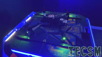
Chennai: First responders entering an unknown indoor environment for search-and-rescue operations during a disaster can soon map the space by wearing advanced technology. Researchers at a prominent institution have developed a real-time indoor mapping system that utilizes wearable devices to create detailed layouts of unfamiliar areas. This groundbreaking innovation aims to enhance the efficiency and safety of rescue operations in emergencies, allowing teams to navigate complex environments more effectively.
The technology works by integrating sensors and advanced algorithms to generate accurate maps in real-time. As responders move through the space, the system continuously updates the layout, providing critical information about obstacles and escape routes. This capability is particularly vital in scenarios such as earthquakes, fires, or building collapses, where visibility can be severely compromised.
With this new tool, emergency personnel can make informed decisions quickly, improving their chances of locating and assisting individuals trapped in hazardous conditions. The initiative highlights the commitment to leveraging technology for humanitarian efforts, ultimately saving lives during crises.
MORE NEWS

July 16, 2026 - 08:32
'It's time to come forward': Investigators revisit 2006 Vero Beach murder with new DNA technologyInvestigators in Indian River County have taken a fresh look at the 2006 murder of 87-year-old Helen McPherson, hoping that advances in DNA technology and artificial intelligence can finally crack...
July 15, 2026 - 18:44
From AI cameras to drones, Fairfax Co. uses new technology in policingPolice in Fairfax County, Virginia, are rolling out a suite of new technologies that rely on artificial intelligence to change how officers work on the street and at their desks. The department now...

July 15, 2026 - 04:21
Trump to address defense technology gathering as the Iran war has reduced US weapon stocksWASHINGTON (AP) -- President Donald Trump is scheduled to deliver a keynote address at a defense technology conference hosted by the U.S. Army War College on Wednesday. The event comes at a...
July 14, 2026 - 21:07
Corporate Technologies Ranked on 2026 MSP 501, Tech Industry's Most Prestigious List of Global Managed Service ProvidersCorporate Technologies, a managed services provider that has served businesses across the country since 1981, has been named to the 2026 MSP 501 list. The MSP 501 is widely recognized as the...